Rare ‘triple-dip’ La Nina predicted in 2022 by UN weather agency
More droughts and flooding are being predicted as the La Nina weather pattern goes into its third consecutive winter – something known as a “triple dip”.The UN’s World Meteorological Organisation (WMO) predicts it will last until at least the end of the year.
That means it will have spanned three consecutive northern winters for the first time this century.La Nina is the cooling of ocean surface temperatures coupled with winds and rainfall.It tends to have the opposite effect to El Nino, which is the warm phase of the so-called El Nino Southern Oscillation.
It was in the last six weeks that La Nina conditions strengthened in the tropical Pacific, affecting temperatures and rain patterns and making drought and flooding worse in different parts of the world.According to the WMO’s El Nino/La Nina Update, the current La Nina – which began in September 2020 – is likely to continue over the next six months.There is a 70% chance of that happening between September and November, and a 55% chance between December and February.Read more on Sky News:Pakistan floods – satellite images and maps show scale of disaster
Advertisement
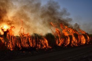
Image:
A man rides a motorcycle through flood water in Nowshera, Pakistan
“It is exceptional to have three consecutive years with a La Nina event,” said WMO Secretary-General Petteri Taalas.”Its cooling influence is temporarily slowing the rise in global temperatures – but it will not halt or reverse the long-term warming trend.”A worsening drought in the Horn of Africa and southern South America bear the hallmarks of La Nina, Mr Taalas added, as does above-average rainfall in southeast Asia and Australasia.”The new La Nina update unfortunately confirms regional climate projections that the devastating drought in the Horn ofAfrica will worsen and affect millions of people,” he added.
More droughts and flooding are being predicted as the La Nina weather pattern goes into its third consecutive winter – something known as a “triple dip”.
The UN’s World Meteorological Organisation (WMO) predicts it will last until at least the end of the year.
That means it will have spanned three consecutive northern winters for the first time this century.
La Nina is the cooling of ocean surface temperatures coupled with winds and rainfall.
It tends to have the opposite effect to El Nino, which is the warm phase of the so-called El Nino Southern Oscillation.
It was in the last six weeks that La Nina conditions strengthened in the tropical Pacific, affecting temperatures and rain patterns and making drought and flooding worse in different parts of the world.
According to the WMO’s El Nino/La Nina Update, the current La Nina – which began in September 2020 – is likely to continue over the next six months.
There is a 70% chance of that happening between September and November, and a 55% chance between December and February.
Read more on Sky News:
Pakistan floods – satellite images and maps show scale of disaster
“It is exceptional to have three consecutive years with a La Nina event,” said WMO Secretary-General Petteri Taalas.
“Its cooling influence is temporarily slowing the rise in global temperatures – but it will not halt or reverse the long-term warming trend.”
A worsening drought in the Horn of Africa and southern South America bear the hallmarks of La Nina, Mr Taalas added, as does above-average rainfall in southeast Asia and Australasia.
“The new La Nina update unfortunately confirms regional climate projections that the devastating drought in the Horn of
Africa will worsen and affect millions of people,” he added.