New Mars Water Map Shows Traces of Ancient Water, Might Help Locate Landing Sites For Future Missions
The ongoing quest for signs of ancient life on Mars has seen several landers, orbiters, and spacecraft attempt to gain deeper knowledge about the Red Planet. Now, scientists have utilised data collected over a decade by NASA and the European Space Agency (ESA) to create a water map of the planet. Featuring sites of aqueous minerals, the map sheds light on the ancient traces of water on Mars and is expected to help scientists zero in on locations ideal for landing future Mars missions. Pieced together meticulously, the map shows a location with an abundance of aqueous minerals. These minerals are the result of rocks that were chemically altered by the action of water on them in the past.The interaction between rocks and water leads to the formation of clay on Earth, and different conditions can result in diverse types of clays. When the amount of water is more, the soluble elements tend to wash away leaving behind clays such as kaolin that are rich in aluminium. The new map features thousands of sites in the oldest regions of Mars containing such minerals.To create the map, researchers used data from the ESA’s OMEGA instrument and the Mars Reconnaissance Orbiter Compact Reconnaissance Imaging Spectrometer for Mars (CRISM) instrument of NASA. Working in the same wavelength range and having sensitivity to the same minerals, both instruments proved to be ideal for the mapping.Previously, it was known that aqueous minerals were present in smaller numbers on the planet indicating that water was limited in both extent and duration. Now, the map has made it clear that water had a significant role to play in shaping the geology around the Red Planet.“I think we have collectively oversimplified Mars,” said planetary scientist John Carter of the University of Paris-Saclay. He added that initially, it was thought that only a few types of clays formed on Mars during the wet period, but the new map even features some intimate mixing of salts and clays and some salts that could be older than some clays.The findings have been published in two papers in the journal Science Direct.
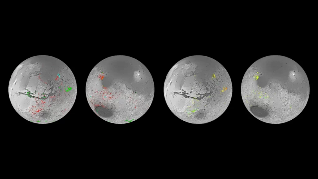
The ongoing quest for signs of ancient life on Mars has seen several landers, orbiters, and spacecraft attempt to gain deeper knowledge about the Red Planet. Now, scientists have utilised data collected over a decade by NASA and the European Space Agency (ESA) to create a water map of the planet. Featuring sites of aqueous minerals, the map sheds light on the ancient traces of water on Mars and is expected to help scientists zero in on locations ideal for landing future Mars missions. Pieced together meticulously, the map shows a location with an abundance of aqueous minerals. These minerals are the result of rocks that were chemically altered by the action of water on them in the past.
The interaction between rocks and water leads to the formation of clay on Earth, and different conditions can result in diverse types of clays. When the amount of water is more, the soluble elements tend to wash away leaving behind clays such as kaolin that are rich in aluminium. The new map features thousands of sites in the oldest regions of Mars containing such minerals.
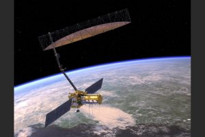
To create the map, researchers used data from the ESA’s OMEGA instrument and the Mars Reconnaissance Orbiter Compact Reconnaissance Imaging Spectrometer for Mars (CRISM) instrument of NASA. Working in the same wavelength range and having sensitivity to the same minerals, both instruments proved to be ideal for the mapping.
Previously, it was known that aqueous minerals were present in smaller numbers on the planet indicating that water was limited in both extent and duration. Now, the map has made it clear that water had a significant role to play in shaping the geology around the Red Planet.
“I think we have collectively oversimplified Mars,” said planetary scientist John Carter of the University of Paris-Saclay. He added that initially, it was thought that only a few types of clays formed on Mars during the wet period, but the new map even features some intimate mixing of salts and clays and some salts that could be older than some clays.
The findings have been published in two papers in the journal Science Direct.